Today's weather conditions remain favorable for any final holiday shopping activities, with partly sunny skies expected throughout the day. Although temperatures may not match yesterday's warmth, afternoon readings should still hover approximately 5 degrees above seasonal norms.
Precipitation makes a comeback later tonight, primarily after midnight, with most rainfall expected to clear before Christmas Day dawns. Tomorrow's highs will climb into the mid to upper 40s range.
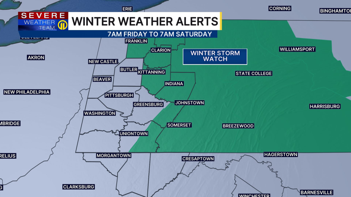
A new weather system approaches Friday afternoon and evening, delivering more persistent rainfall. Areas located north and east of Pittsburgh face additional concerns as temperatures may struggle to rise above the low 30s, creating potential for freezing rain. This could lead to significant ice accumulation in Armstrong and Indiana counties, along with elevated sections of Westmoreland and Fayette counties. Travel conditions may become particularly dangerous for those journeying eastward into Pennsylvania's central regions.
Saturday offers a respite for travel plans before additional rainfall arrives late Sunday. Weekend temperatures could approach 60 degrees before a sharp decline early next week. The weather pattern appears poised to turn significantly colder as 2025 concludes.