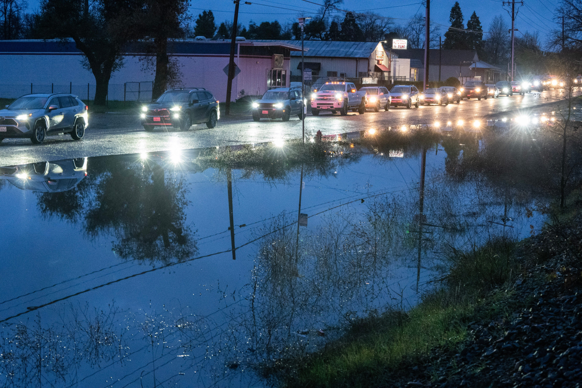
Redding and Shasta County are bracing for significant weather disruptions throughout the Christmas holiday period, with forecasts predicting persistent rainfall and powerful winds that elevate concerns for flooding, power failures, and potential landslides.
Flood Watch in Effect
The National Weather Service has activated a flood watch for Shasta County and surrounding regions, valid until 4 p.m. on Friday, Dec. 26. This alert encompasses the Shasta Lake Area, Burney Basin, eastern mountain zones, the Redding vicinity, and Interstate 5 within the county.
According to the holiday forecast released on Dec. 22, a succession of warm, windy atmospheric rivers is expected to deliver 2-3 inches of rain to Redding from Monday to Tuesday, with 1-2 inches anticipated in nearby areas. This follows substantial precipitation, with the Redding region receiving up to 8 inches of rain as of Sunday, Dec. 21.
Projected rainfall from Wednesday through Friday, Dec. 24-26, includes:
4-6 inches in Redding
6-8 inches at Sims, located south of Castella along Interstate 5
3-4 inches in Burney, Red Bluff, Susanville, and Hayfork
The weather service cautioned, "The prolonged period of rain will bring the risk of flooding to the (whole) Sacramento Valley, northern San Joaquin Valley, northern Sierra Nevada and adjacent foothills" and North Coast, advising motorists to limit driving where possible.
High Wind Conditions
A high wind watch is also in place from 4 p.m. Tuesday, Dec. 23 to 4 p.m. Friday, Dec. 26 for the Sacramento Valley, covering areas north of Redding to Red Bluff. Forecasts indicate sustained south winds of 25-35 mph, with gusts potentially reaching 60 mph, which could impair visibility for drivers.
With soils already saturated, these strong gusts may topple trees and power lines, and could dislodge outdoor holiday decorations and other unsecured objects, forecasters noted.
Winter Storm Warning
A winter storm warning has been issued for mountain and foothill communities in the North State, including Burney and Lake Shasta, from Wednesday afternoon through Friday night. Snow levels are expected to remain above 5,000 feet until Wednesday, then decrease to around 3,500 feet by Thursday evening as winter storms bring snowfall rates of up to an inch per hour.
The weather service alert warned of "dangerous travel conditions with chain controls and road closures," along with potential tree damage, power outages, and "low visibility due to the combination of heavy wet snow and strong winds."
Snowfall is also forecast for the Sierra Nevada, with mountain towns like Chester and Quincy expecting 4-8 inches, while Lassen Volcanic National Park could see 72-96 inches between Christmas Eve and Friday. According to the U.S. Forest Service, Lassen Peak holds the record for the snowiest location in California.