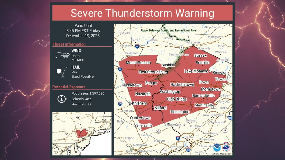
On Friday afternoon, the National Weather Service activated several weather alerts throughout New Jersey. This included new severe thunderstorm warnings affecting ten counties and a flood warning in one county.
Thunderstorm Warnings
The thunderstorm warnings, which remain effective until 3:45 p.m., apply to Atlantic, Burlington, Camden, Gloucester, Hunterdon, Mercer, Middlesex, Monmouth, Ocean, and Somerset counties. Despite sunshine in some areas over the previous two hours, new thunderstorm cells developed in eastern Pennsylvania and began moving into parts of New Jersey.
Earlier in the afternoon, a separate thunderstorm warning was in place for sections of Camden, Gloucester, Hunterdon, Salem, and Warren counties, but it expired at 2:45 p.m.
The National Weather Service stated that the latest thunderstorms are producing strong gusty winds, which "could damage roofs, siding, trees and power lines."
Flood Warning
A flood warning is active until 4:30 p.m. Friday for Hunterdon County. Excessive rainfall combined with snowmelt has led to flooding in rivers, creeks, and streams.
According to the weather service, the U.S. Geological Survey gauge on the Neshanic River at Reaville recorded a level of 6.63 feet at 12:21 p.m., surpassing the flood stage of 6.5 feet.
Since Thursday night, rainfall between 1.5 and 2 inches has occurred, with additional runoff from melting snow. The weather service cautions that some roads near the river may close, and flooding in low-lying, flood-prone areas is either happening or expected soon.
Wind Advisories
Wind advisories are in effect until 1 a.m. Saturday for all 21 counties in New Jersey. Forecasters predict west winds of 20 to 30 mph with gusts reaching 40 to 50 mph.
Some gusts are expected to be strong enough to bring down trees and power lines.
Earlier on Friday morning, thunderstorm warnings were issued for nine New Jersey counties as a line of strong storms moved across sections of the state.