A winter storm alert has been issued for the New York City metropolitan area and the broader Tri-State region, with significant snowfall predicted to begin on Friday evening.
Timing and Impact
The weather system is forecast to move into the area during Friday afternoon, intensifying by nightfall. This timing is likely to create difficult conditions for evening commuters, with travel disruptions expected.
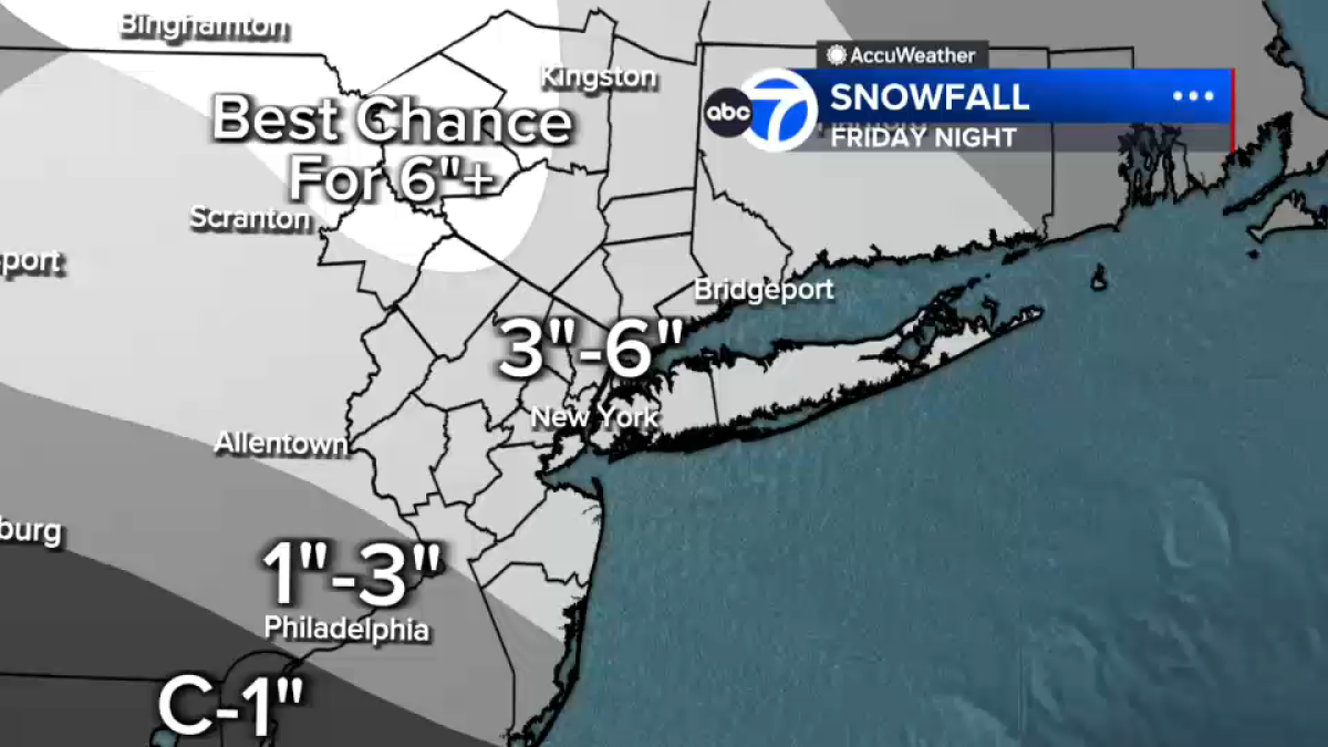
Accumulations are projected to be substantial, with early estimates indicating 3 to 6 inches of snow across many locations, including New York City itself.
Regional Variations
The heaviest snow totals are anticipated in areas north and west of the city. Counties such as Orange, Sullivan, Ulster, and Pike, along with parts of northwestern New Jersey, could receive over half a foot of accumulation.
In central and southern New Jersey, including zones south of Interstate 95, precipitation may mix with rain, which would reduce total snowfall amounts.
Storm Duration
The system is expected to start weakening by Saturday morning. In New York City, snow may transition to a wintry mix at that time. However, hazardous travel conditions could persist even as the storm begins to subside.