As holiday travel reaches its peak, weather systems across the United States could create challenging conditions for travelers through the Christmas period.
Monday Conditions
Monday offers generally favorable travel weather nationwide, though some regional issues may arise. In the West, Northern California faces persistent heavy rainfall that could trigger flash floods and landslides. Washington and Oregon will experience ongoing precipitation with mountain snow in the Cascades. The northern Rockies anticipate valley rain, mountain snow, and strong winds that may complicate mountain pass travel.
The South may see scattered showers in the lower Mississippi Valley, though these shouldn't cause major delays. Meanwhile, the Midwest expects light snow possibly mixed with sleet or freezing rain around the Great Lakes region, potentially creating slippery road conditions.
Tuesday Forecast
This important pre-Christmas travel day presents more weather concerns in both eastern and western regions. The Northeast may encounter light snow, sleet, or freezing rain, particularly in New England and interior areas from northern Pennsylvania to upstate New York. Some wintry precipitation could reach the New York City area early in the day. Rain showers and gusty winds are possible in the mid-Atlantic and Ohio/Tennessee Valleys.
In the West, a stronger storm system approaches California with heavy rain and strong winds beginning in Northern California before spreading southward Tuesday night. This system may also bring precipitation to parts of Washington, Oregon, northern Idaho, and northwest Montana.
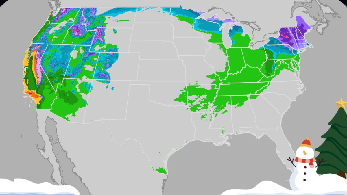
Christmas Eve Weather
The West faces the most significant travel challenges on Christmas Eve. Heavy rain continues across California including major metropolitan areas, with potential extension into the Desert Southwest reaching Las Vegas and possibly Phoenix. Flash flooding risks exist, especially near recent wildfire zones. Interstate 80 through the Sierra Nevada could see dangerous conditions. The Northwest and northern Rockies may experience additional rain and mountain snow.
Central and Eastern regions might encounter low clouds, fog, and light showers in the Midwest as warmer air moves northward, potentially causing morning flight delays at major hubs.
Christmas Day Outlook
Another potent Pacific storm affects the West on Christmas Day with additional heavy rain, strong winds, and significant Sierra snowfall. This system will impact the Northwest, Great Basin, Desert Southwest, and Rockies with valley rain and mountain snow.
In the Midwest and Northeast, forecast uncertainty remains, but light rain may affect the Great Lakes and Ohio Valley during daytime hours. By evening, moisture reaching colder air over upstate New York and northern New England could produce light freezing precipitation. Windy conditions are expected across the Plains, Great Lakes, Ohio Valley, and mid-Atlantic.
Post-Christmas Conditions
The Pacific storm continues eastward across the Intermountain West on December 26th, bringing persistent rain, wind, and mountain snow to the Sierra Nevada, Cascades, and Rockies. The Northeast may see showers in southern areas transitioning to possible snowfall in New England. A quick-moving system could bring snow to northern Minnesota and the Great Lakes region.
Saturday Weather
Western weather begins to improve on Saturday with precipitation tapering off after days of unsettled conditions. Some lingering rain and snow may affect areas west of the Rockies including Central and Southern California, with possible travel issues around Seattle.
In central and eastern regions, snow and winter weather may affect the Northern Tier including the Great Lakes and parts of New England. Rain extends southward into the Ohio Valley and Southern states, though these showers should primarily cause minor inconveniences rather than major delays.
Travelers should monitor forecast updates regularly as conditions may change. Wishing everyone safe and enjoyable holiday travels.