California is under extensive flood watches this week as a series of powerful atmospheric river storms approaches, threatening significant rainfall and potential flooding just before Christmas.
The National Weather Service has issued flood alerts for most of California through Friday, as multiple moisture plumes from the Pacific move inland. These systems are expected to bring prolonged heavy rain to both Northern and Southern California, increasing risks of flash and urban flooding. Approximately 40 million residents are affected by these alerts during the holiday period.
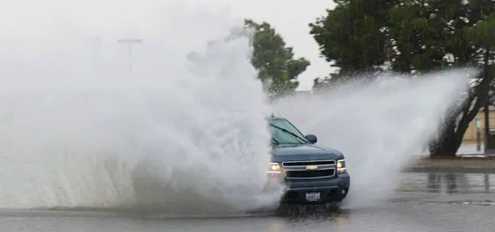
This storm pattern has already caused dangerous flooding in areas like Redding over the weekend, where emergency crews performed water rescues and one fatality occurred on flooded roads. The situation is expected to worsen.
"Tuesday through Saturday looks to be an extended period of significant rainfall," the National Weather Service office in Los Angeles wrote. "By Saturday evening, rainfall totals will range 4–8 inches across coastal and valley areas to 8–12+ inches across the foothills and mountains." Please take the necessary protective actions as flooding and debris flow will be a major issue this upcoming week."
In addition to flooding, the storms bring high winds and significant snowfall at higher elevations, with several feet of snow forecast for the Sierra Nevada. This creates travel hazards over major mountain passes during one of the year's busiest travel weeks.
Emergency officials statewide are advising residents to prepare by securing outdoor items, avoiding flooded roads, and signing up for local alerts. Some communities near recent wildfire burn scars have received evacuation warnings due to increased debris flow risks from saturated soil.
Preparing for Heavy Rainfall
The weather service recommends these preparation steps for heavy rain:
Clear gutters of leaves and debris from recent winds.
Exercise caution at low-water crossings where street drains may back up.
Drive slowly on interstates, bridge ramps, and when turning, as oil on roads can make surfaces slick when wet.
Anticipate rising creek levels in mountain and hill regions.
Monitor local forecasts for rainfall timing and amounts.
Weather Risk Information
Rainfall risk maps indicate the probability of exceeding flash flood guidance, with colors representing different risk levels: pink for high chance (70% or greater), red for moderate (40% or greater), yellow for slight (15% or greater), green for marginal (5% or greater), and gray for low risk (less than 10%).